The Three Passes Trek is considered the hardest multi-day journey to Everest. In a period of 17 to 20 days, you ascend to six peaks that are higher than 5300m, climb near vertical terrain, and gaze at four of the world's eight tallest mountains: Cho Oyu (8201m), Makalu (8481m), Lhotse (8414m) and Everest (8848m). Instead of short days followed by acclimatization hikes, the Three Passes trek takes you on long days that end with glaciers, boulders bigger than houses, and valleys straight out of Lord of the Rings. In short, it's the ultimate Everest experience, especially when you organize it in your own, trek it without guides or porters, and pick up amazing friends along the way.
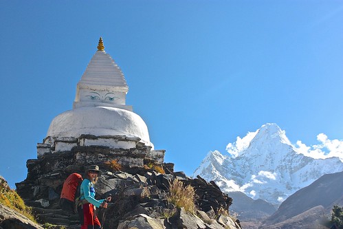
Here's our account of 17 days that were among the most difficult of our lives. For trekking days 1-4, 9-12, and 13-17, click on the respective links.
NOTE: I took the iPad with me on our trek and wrote most of this trip diary in real-time. Because of that, it doesn't share the same format as our other posts, but it does provide an accurate account of our oscillating excitement and exhaustion on the mountain.
Total Spent Over 17 Days: US$1309 (including flights to/from Lukla, permits, all food and lodging) Average Spent Per Person/Day: US$38.50
Day 5: Deboche to Dingboche (4410m)
Stats: 4.5 hours trekking with pack
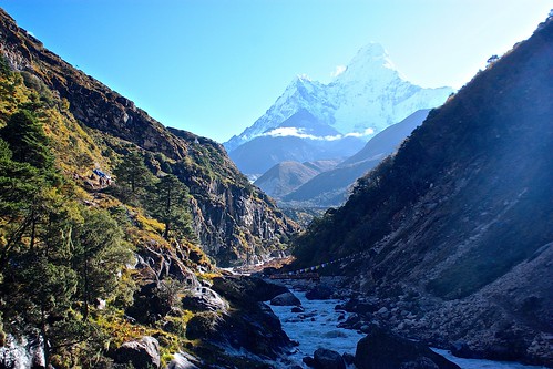
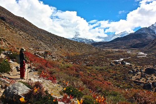
It was a clear morning when we hit the trail at 7:30am and views of Everest, Lhotse, and Ama Dablam (6856m) greeted us as we descended down to the river. The temperature must have been close to freezing, but as soon as we crossed the river and headed uphill, it felt much warmer. Rob stripped his layers, but I kept my GoreTex pants on, which worked out about an hour later when we reached 4200m and the wind picked up.
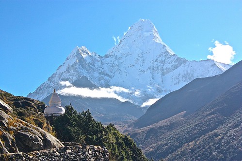
Today's trek was relatively easy despite the gain in altitude and the last 300m, which were essentially straight up. In order to arrive at Dingboche and not Pheriche, you need to follow the trail down to the river, cross the small bridge, and climb up the hill. The split with Pheriche isn't marked, so it's easy to miss.
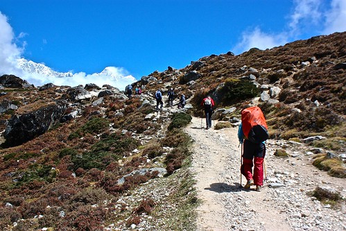
In Dingboche, we settled in to a room at Peaceful Lodge, which we got for free on condition of eating three meals there. The food up here was definitely more expensive than the previous days, but I'm pretty sure that's the case for all the lodges.
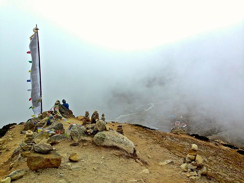
After lunch, we did an acclimatization hike up the nearby hill and got us far as the pole strung with prayer flags. We were probably at around 4800m and were okay on breath, but my head was pounding.
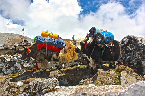
After descending, Rob interviewed porters and I lay in bed with a killer headache. It was so bad that I couldn't eat dinner. I took two Tylenol and went to bed around 8pm, but Rob did manage to secure a porter-guide who had done the Kongma La pass and agreed to help us for the next few days.
Day 6: Dingboche to Chhukhung (4730m); day hike to Island Peak Base Camp (5068m)
Stats: 2 hours trekking with light load to Chhukhung; 4 hour day hike to Island Peak
We had an exciting start to the day as the porter we booked never showed up. Rob went for a walk around town trying to find him and finally spotted him hanging out with a bunch of other porters and guides. We're not exactly sure what happened, but we came to understand that he already had another client and was trying to find someone to take us. Ten minutes later that someone came to our lodge and told us that he already had a group of Chinese clients who were doing the same itinerary as us and that we were welcome to join the group. We felt a bit awkward about the whole thing, so we told him we'd go with him for the day and then discuss with his clients that night.
Trekking without the pack was easy, despite the 200m elevation gain. Even going slow, we made it to Chhokhung in about two hours, where we checked in to Sunrise Lodge. Rob again managed to secure our accommodation for free!
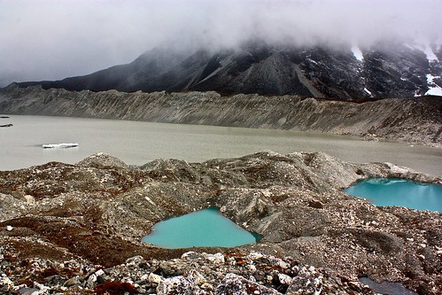
Unfortunately, this afternoon was even cloudier than the other ones so we couldn't see the views this town was famous for. Regardless, we made the decision to trek to Island Peak Base Camp for acclimatization. The base camp is at 4970m, but the trail there goes up to almost 5100m, so it was a more difficult hike than we anticipated. Both of us had a bit of a headache despite taking it slow.
We made it as far as Imjo Tsho, a huge lake with two bright blue lakes next to it.
After returning to town, we made final arrangements with the guide and porter, okayed everything with their clients, had dinner, and went to bed.
Day 7: Acclimatization day in Chhukhung; day hike attempt to Chhukhung Ri (5550m)
Stats: Less than 2 hours of very slow walking
Rob had a splitting headache in the middle of the night, which kept both of us up and made us reevaluate the rest of our itinerary. We were supposed to hike to the top of Chhukhung Ri (5550m) in the morning, but waking up to clouds made us feel less motivated than usual.
With lackluster energy and fuzzy heads, we spent the morning napping and discussing whether we really wanted to attempt the Kongma La pass the following day. At 5535m, it is the highest and most difficult of the Three Passes and even without packs, I was starting to feel that we couldn't do it.
At about 11am, we saw the Chinese group of trekkers who we were supposed to join for the passes walk outside our window. Rob ran out to ask whether they attempted Chhukhung Ri. They had, and all made it to the top. Armed with this new information, we put on our trekking gear and headed outside to attempt to conquer 5550m. About 20m in, I felt exhausted and after much deliberation, we decided to take our Diamox, an altitude sickness pill.
Perhaps it helped a bit, but either way, I couldn't make it to the top. It was super cloudy out so there were no views to speak of and my burning calves and lungs made each step feel like I was tied up in shackles. At around 5100m, we turned around, defeated. Not making it up meant we most likely would not be attempting the Kongma La pass the following day.
I was reminded of a reoccurring theme in Into Thin Air: arrogance kills. We may have been fit, but this mountain was getting the better of us, and we had to be okay with that--at least until our bodies felt better.
Day 8: Kongma La Pass (5535m) to Lobuche (4910m)
Stats: 8 hours trekking with light load
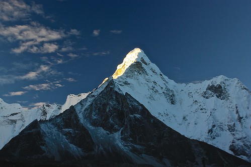
We woke up without headaches and with an incredible view, so we decided to go for it. Kongma La Pass it would be and by 7:15am, we were pushing ourselves up the mountain.
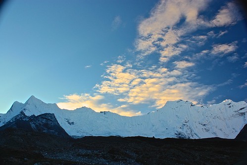
Unfortunately, at about 8am the clouds rolled in and obscured the scenery that had motivated us that morning. Still, with light packs and a dose of Diamox we were doing pretty well on the 800m climb to Kongma La. The toughest point came about three hours into the trek when we had a near vertical 300m gain. One foot in front of the other got us to the top, where we had a view of the serene miniature lake that had formed at the foot of the mountains.
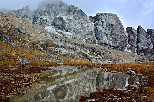
The Chinese trekkers and our guide were far behind us so we befriended a group of three Israelis who were resting by the lake. Matan, Nadav, and Rotem immediately invited us to share some delicious freshly brewed black coffee, so it's no surprise that they quickly became our trekking buddies for the rest of our time on Everest.
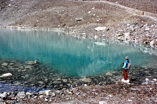
Our guide, handing out biscuits and boiled potatoes, said the worst was over, but we knew from our GPS that we still had nearly 200m of vertical climb left despite already being at 5400m in height. On the way to the pass, we walked by another lake and then climbed to the highest point of our lives--5535m!
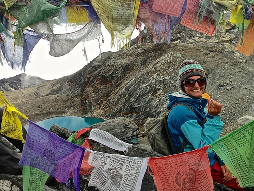
After water, biscuits, and protein bars, it was time to move--nearly all the way back down to the altitude at which we had started and over the Khumbu Glacier to Lobuche. The 600m descent was incredibly steep and difficult, with loose rocks and scree slipping out from under your feet each step you took. Thankfully, there was more air.
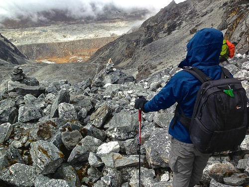
But our day didn't end at the bottom, as the rocky and icy Khumbu Glacier was still up ahead. We again waited for the Chinese trekkers to catch up to us before maneuvering our way back up and into the glacier's walls.
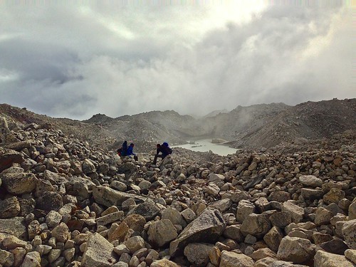
The Khumbu Glacier is one of the most difficult passes in the park and many trekkers get lost here, so we invited our new Israeli friends to follow along with our guide. He said it would take 30 minutes, but it took us almost one hour as the crossing required repeated ups and downs over ice and rock.
The scariest moment of the crossing came when I stepped on loose rock and the shelf fell down from below my right foot straight into the glacial abyss. I froze there, one foot in the air.
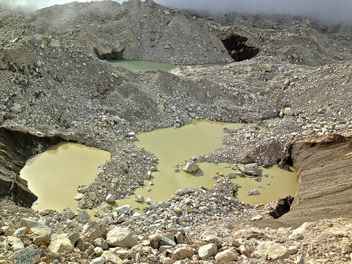
Rob yelled, "Move," but it took a moment for me to realize he was screaming at me.
A few seconds later, I jumped onto a bigger rock as the small stones from where I had just been standing slid into the glacial lake.
From there, I nearly ran to Lobuche, where I collapsed into my free bed and nearly cried with happiness. We had made it over Pass One.
More Everest
For more detail on trekking days 1-4, 9-12, and 13-17, please click on the respective links. You can also check out our top tips for hiking Everest Base Camp.
Interested in seeing Mount Everest and the Himalayas without the pain of trekking? Check out our Everest Three Passes photo tour.
You can also share your tips for trekking Everest on a budget by leaving a comment!
Comments